RESIDENTIAL: FLOOD HAZARD MAPS & FLOOD INSURANCE STUDIES
CONTACT INFORMATION
Main Office, City Hall
200 Forrest Street
1st and 2nd Floor
601-545-4609
Code Enforcement
601-554-1027
Planning
601-545-4599
Building
601-554-1028
Neighborhood Coordinator
601-545-1962
FLOOD PROTECTION LIBRARY
- FEMA NFIP Public Awareness Materials for Insurance Agents, Realtors and Lenders “Before, During and After the Flood”
- FEMA P-347, Above the Flood: Elevating Your Floodprone House (2000)
- Answers to Questions about the National Flood Insurance Program
- FEMA P-55, Coastal Construction Manual: Principles and Practices of Planning, Siting, Designing, Constructing, and Maintaining Residential Buildings in Coastal Areas (4th ed.)
- FEMA 54, Elevated Residential Structures (1984)
- Mandatory Purchase of Flood Insurance Guidelines
- FEMA P-85, Protecting Manufactured Homes from Floods and Other Hazards (2009)
- FEMA 257, Mitigation of Flood and Erosion Damage to Residential Buildings in Coastal Areas (1994)
- FEMA 348, Protecting Building Utilities from Flood Damage (1999)
- FEMA – Protect Your Property
- FEMA – Protecting Your Home or Small Business from Disaster
- FEMA – Protecting Yourself Through Mitigation
- Protecting Floodplain Resources – A Guidebook for Communities
- Reducing Damage from Localized Flooding: A Guide for Communities
- Coastal Construction Manual Brochure
- Browse 6,075 FEMA Document and Manuals
- Cleaning Up Your Home After A Flood
- FEMA High Water Mark Initiative
- Sea Level Rise and Coastal Flooding Impacts
- Critical Habitat Mapper
- Flood Insurance Residential Coverage
- SLOSH – Sea, Lake, and Overland Surges from Hurricanes
Mississippi State Flood Information:
- MEMA flood preparation information.
- Lower Mississippi river forecast center via NOAA.
- Prepare Your Evacuation Route – MDOT on Hurricane Prep (YouTube Video)
- NOAA facilities and programs in Mississippi. (.pdf)
- 2015 Hurricane Evacuation Guide and Map (.pdf)
FEMA (1970 – 2010) Flood Hazard Maps and Flood Insurance Studies
- 28035C0020C
- 28035C0040C
- 28035C0045C
- 28035C0080C
- 28035C0085C
- 28035C0109D
- 28035C0117D
- 28035CIND0
- 28035CIND0A
- 28073C0060C
- 28073CIND0
- 280053
- 280053IND0_0882
- 2800530005B
Click to return to the Flood Information page.
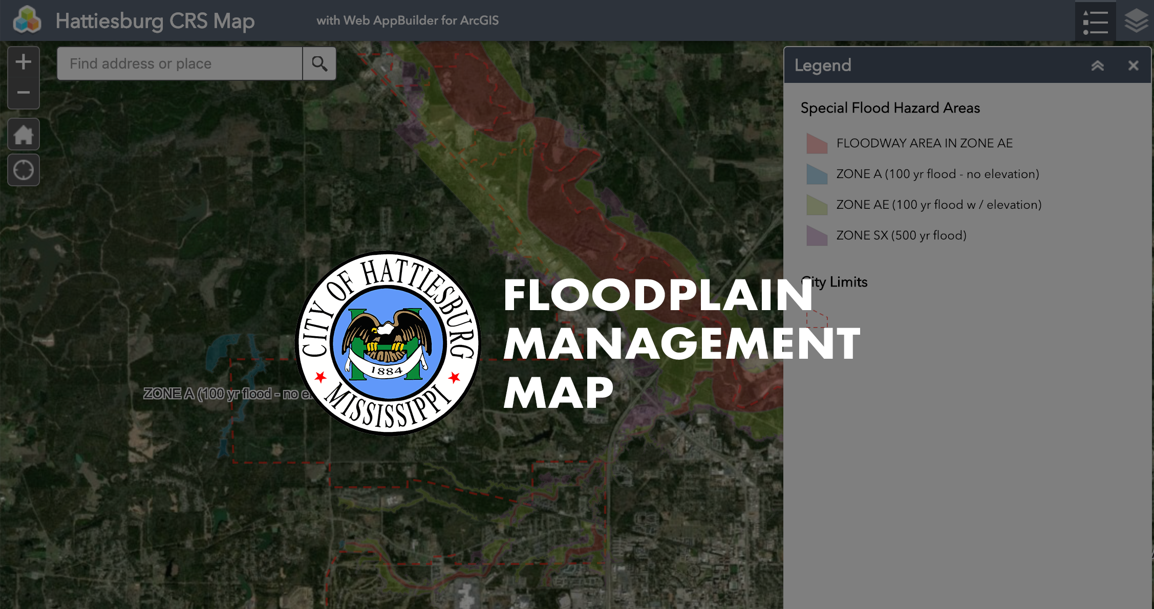
For a map that highlights the City’s current floodways and zones, click the image below.
To help limit the severity of floods and resulting damages, a Building Permit must first be obtained any time development is to take place within Hattiesburg. The proposed work is checked for compliance with the City’s Flood Damage Prevention Ordinance. Development within the floodplain is closely controlled, and is prohibited if any increase in the flood hazard results.