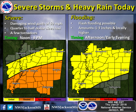
The NWS in Jackson has placed us under an elevated risk for severe storms moving into our area this afternoon. The primary threat associated with this event will be wind gusts up to 60 mph, quarter to half dollar sized hail, and the possibility of a tornado. In addition, flash flooding is a concern with 1-3 inches of rainfall expected. In regards to timing, we can start to see some activity beginning around 2 or 3 o-clock and lasting until late tonight. Unfortunately, this type of event is not forecasted to form a defined line of storms. Therefore, it is very likely that severe storm cells may be scattered making the timing hard to predict.
In regards to Friday most of the rainfall should be out of our area by daybreak. We are not expected to see any ice as temperatures are not favorable for development on roadways. If you have plans to travel North of I-20, please be aware that you will run into some snow, up to 4” in some areas.