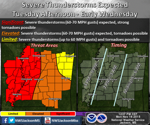
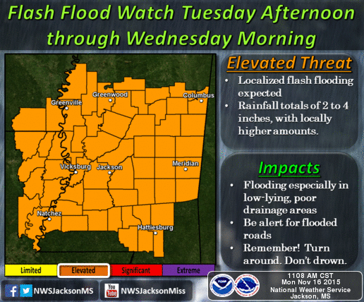
The NWS in Jackson is forecasting that a strong line of thunderstorms will move into our area starting late Tuesday night and into early Wednesday morning (12AM to 6AM). The main threats associated with these storms will be heavy winds (60-70 mph gusts) and the potential for a tornado. In addition, heavy rain is expected and some localized flash flooding could occur. Also, there will be some strong gusts ahead of the line as the system moves in.
As with most of these systems, timing could vary depending on the environment. Although the timing graphic below states a 12AM to 6AM window, this could be sooner or later. We are currently under a flash flood watch until Wednesday morning (see graphic below).
We should have a better idea of the exact timing sometime tomorrow afternoon and will send out an update as soon as possible. As always, if you have any questions please feel to contact our office. In addition, be sure to follow us on Facebook at Forrest County Emergency Management Agency for the latest updates.